

#VIDEO | 20 provinces of the Dominican Republic are declared Red Alert after the passage of Tropical Storm Laura
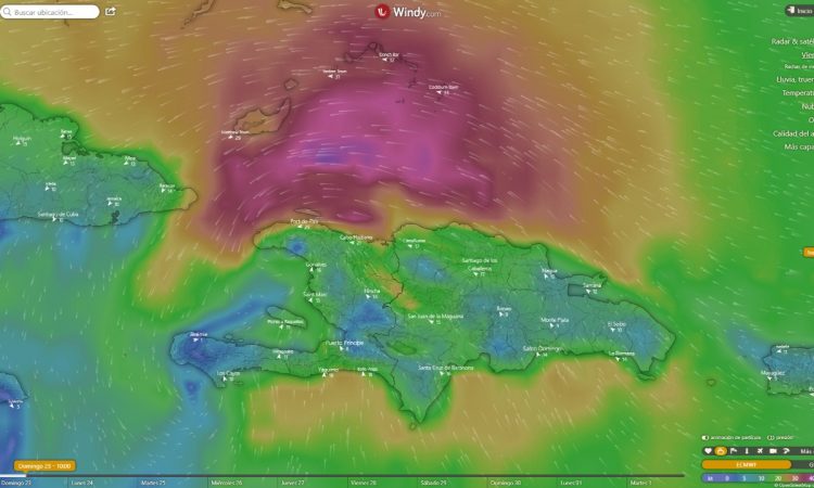
The center of Storm Laura was located at latitude 18.7 north and longitude 70.2 west, about 40 km northwest of Santo Domingo and about 200 km southeast of Monte Cristi, according to the latest bulletin from the Directorate of the Operations Center of Emergencies (COE) issued at 4:00 in the morning of this Sunday.
Laura is moving west / northwest at about 26 km / h, with maximum sustained winds of 75 km / h. Minimum central pressure of 1004 millibars.
Due to the conditions caused by the passage of the storm on Dominican soil, the COE raised to twenty the provinces in red fin and twelve are in yellow.
In addition, the alert levels were expanded due to tropical storm conditions from Cabo Engaño to Punta Palenque and it remains from Cabo Engaño to the Bay of Manzanillo in Monte Cristi, so from now on the following alert levels will govern.
The provinces in red alert are La Altagracia, Samaná, San Pedro de Macoris, Hato Mayor, El Seibo, San José de Ocoa, Santo Domingo, Azua, Barahona, Puerto Plata, Montecristi, Espaillat, María Trinidad Sánchez, San Cristóbal, La Romana , the National District, Monte Plata and Peravia, Sánchez Ramírez, Pedernales.
While they are yellow, Monsignor Nouel, La Vega, Hermanas Mirabal, Duarte, Santiago, San Juan and Bahoruco, Independencia, Santiago Rodríguez, Elías Piña, Dajabón, and Valverde.
Regarding the waves, the National Meteorology Office (Onamet) indicated that they have increased between 10 to 12 feet, increased between 16 and 18 feet offshore, along the entire north coast, as well as for the Caribbean.
The warning is maintained that fragile, small and medium vessels must remain in port, while on the south coast, they must also remain in port, due to the passage of Storm Laura.
From Listín Diario.


